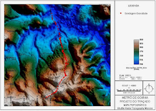
 A Hypsometric map, also known as a relief map, is a map depicting the configuration of the earth’s surface, called the “relief,” by means of contours, form lines, hachures, shading, tinting, or relief models. The specific map is a topographic hypsometric map of the Goiania Metropolitan Region.
Tuesday, January 12, 2010
Hypsometric Map
 A Hypsometric map, also known as a relief map, is a map depicting the configuration of the earth’s surface, called the “relief,” by means of contours, form lines, hachures, shading, tinting, or relief models. The specific map is a topographic hypsometric map of the Goiania Metropolitan Region.
Subscribe to:
Post Comments (Atom)

No comments:
Post a Comment