
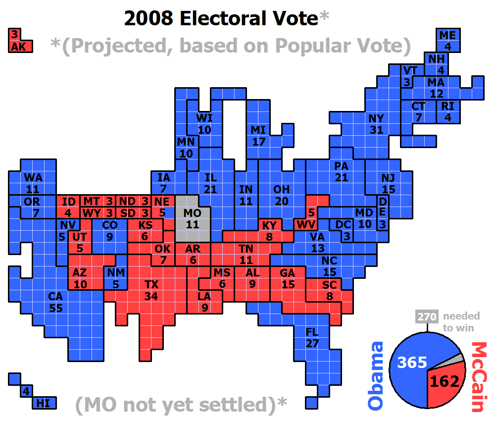
Cartogram maps scale the area of each country in proportion to its population. The shape and relative location of each country is retained to as large an extent as possible, but a large amount of distortion tends to always exist. This map shows the amount electoral votes each state got by the number of squares that make up the state.

No comments:
Post a Comment