skip to main
|
skip to sidebar
Sarah's Map Catalog
Monday, January 11, 2010
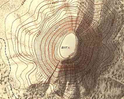
Topographic Map
A Topographic map is a map that shows the relief of an area using contour lines to represent the size, shape, and elevation of the features. In this map, the contour lines are showing the elevation of this mountain.
http://www.compassdude.com/i/topographic-map.jpg
No comments:
Post a Comment
Newer Post
Older Post
Home
Subscribe to:
Post Comments (Atom)
Followers
Blog Archive
▼
2010
(53)
►
April
(11)
►
March
(15)
►
February
(7)
▼
January
(20)
LIDAR
Doppler Radar
Black and White Aerial Photo
Infrared Aerial Photo
Cartographic Animations
Statistical Map
Cartogram
Flow Map
Isoline Maps
Proportional Circle Map
Choropleth Map
Dot Distribution Map
Propaganda Map
Hypsometric Map
PLSS Map
Cadastral Map
Thematic Map
Topographic Map
Planimetric Map
Mental Map
About Me
SarahG
View my complete profile


No comments:
Post a Comment